
PROTECT YOUR DNA WITH QUANTUM TECHNOLOGY
Orgo-Life the new way to the future Advertising by Adpathway
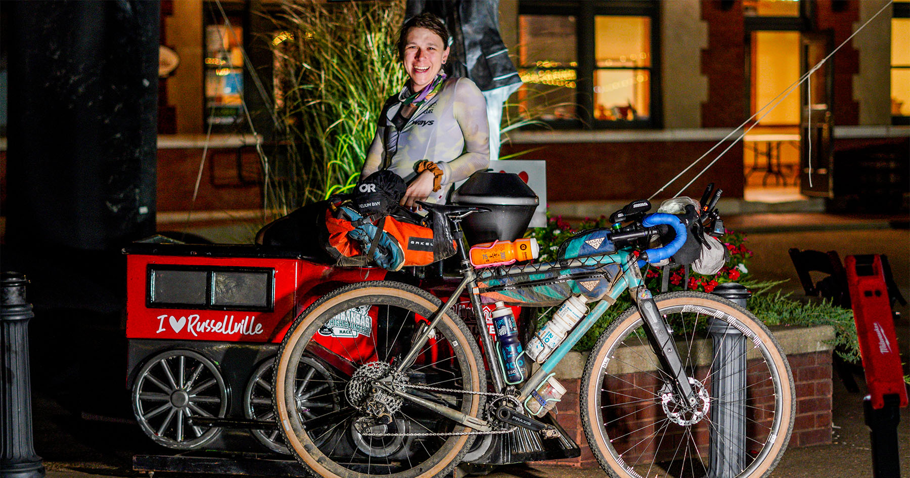
As part of a 10,000-kilometer journey around North and Central America, Turkish bikepacker Serkan Yildiz pieced together an off-road track connecting some of our existing routes through Utah’s iconic landscapes. In this piece, he shares the story of scouting it out and learning a few lessons along the way…
After dreaming of visiting Utah for ages, and now I find myself with my bike and a month to explore as part of my North and Central American tour. I’m sitting in a friendly hostel in Moab, still feeling frustrated about not being able to ride the White Rim Trail two days earlier. The reason is that campsites need to be reserved weeks or months in advance, which is quite challenging for bike travelers who can’t nail down such a specific agenda. Tour agencies and groups book sites well ahead of time, and many don’t even show up.
I run into a group who just finished their guided MTB tour, and they tell me that most campsites were empty. At least I got to ride Shafer Canyon and Potash Road to Moab, which was lots of fun. Sitting in front of the computer trying to find an alternative to Highway 191 leads to this story of my passage through Lockhart Canyon and Bears Ears National Monument.
Moab is a cute small town surrounded by outdoor activity possibilities, such as mountaineering, rock climbing, canoeing, and world-class mountain biking, so there’s no shortage of interesting people around. Or good beer. My five-day stay here leads me to find an intriguing dashed line across Lockhart Basin headed south, then a potential resupply in the Needles District of Canyonlands National Park, heading out again through another interesting dashed line across Bears Ears East, ending with the Valley of the Gods loop and town of Mexican Hat. It seems like I found a trifecta of highway alternatives and a rather challenging yet potentially rewarding Utah adventure I’ve been so thirsty for. No pun intended.

Of course, I didn’t just jump into it. Due diligence first: some online research, chatting with MTB guides and rangers around. It sounds like the first leg, including Lockhart Basin and Canyon, is going to be the more technical part, but it’s doable overall. I pack a few days of food and the maximum water allowance of my setup, nine liters, and head out.
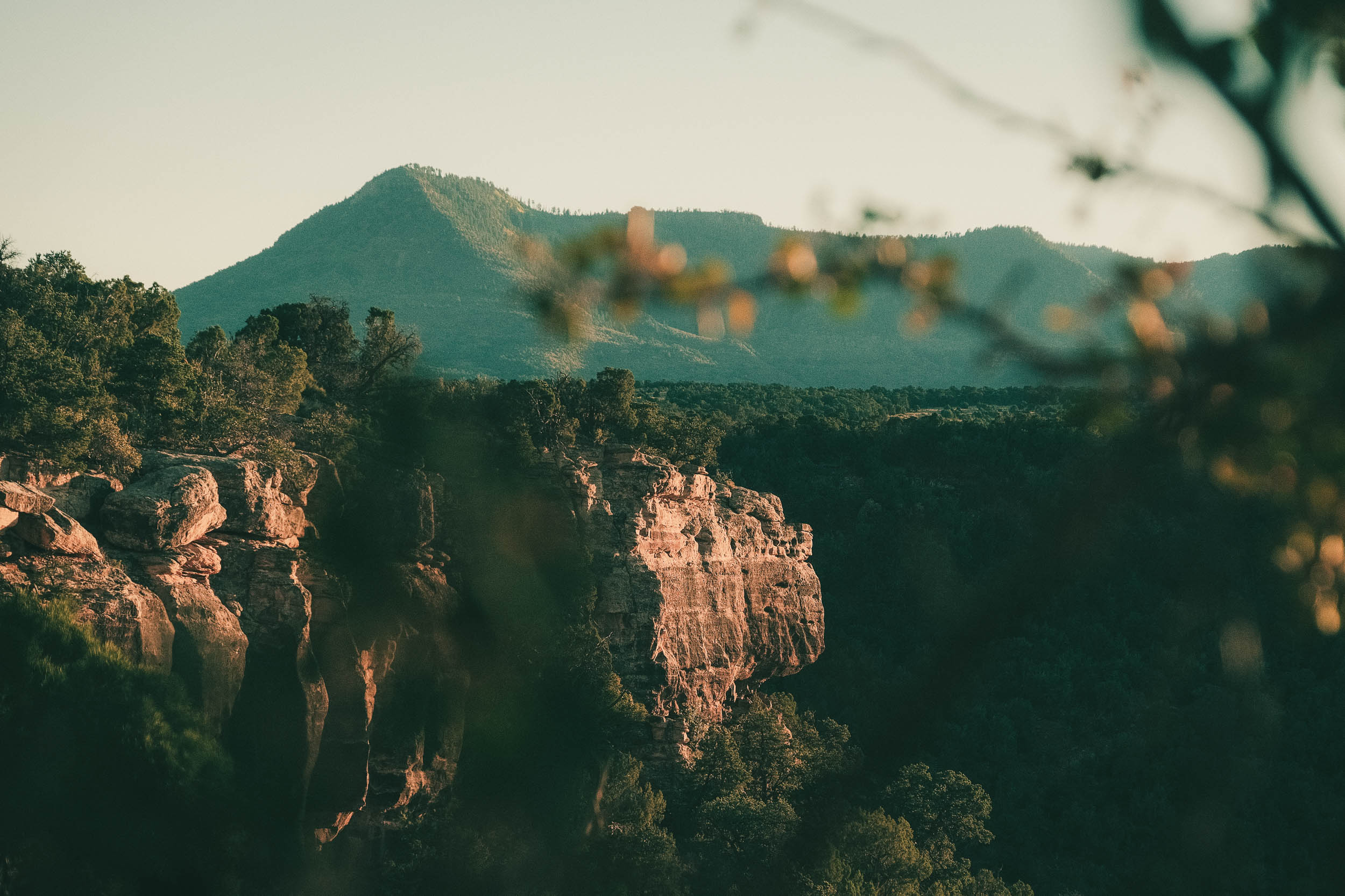
The first section, just after Moab, is light and fun, following a mellow dirt road along the Colorado River. Some petroglyphs can be spotted around. It gradually became increasingly technical and hot. There are many boulders to jump and carry the bike over, plus sand, loose rock, and intense descents. Some roads are just a giant rock. Just about making it to Hurrah Pass, I come across two bikepackers who were dropped at Lockhart Basin and riding back to Moab on an overnighter. They fill me in on what’s about to come, and while I appreciate it, I’m reminded that it’s sometimes better to just experience things for yourself.
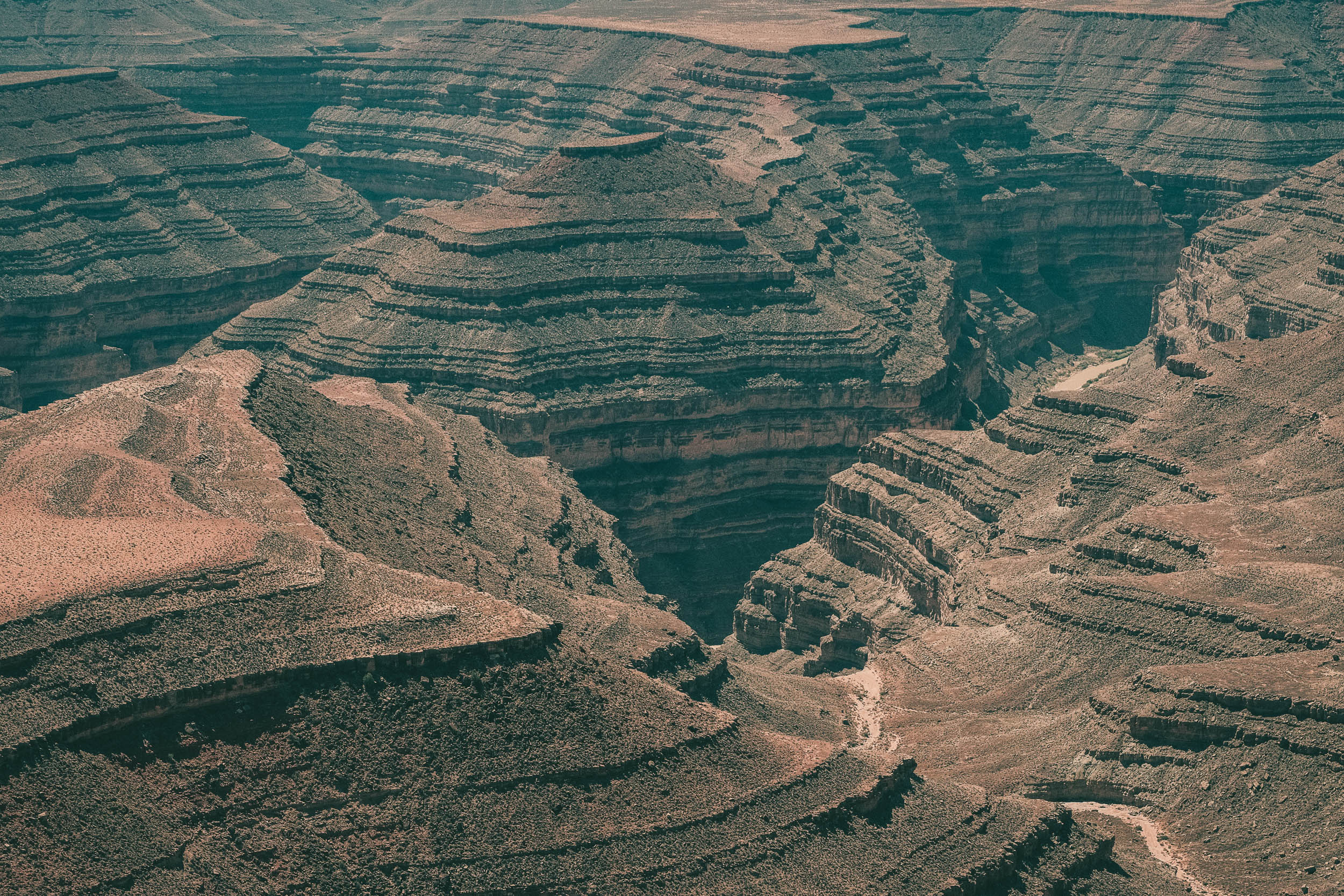
Before our meeting, I naively thought Hurrah Pass would be the challenging part, which turns out not to be true. While the views are stellar as it crosses between canyons with views toward a seemingly infinite horizon, progress is slow. There are either boulders to cross or deep sand to walk through. There’s no resupply; my water supply has to last for three days until the Needles outpost. I set up camp somewhere in the canyon after the pass. My Durston tent is non-freestanding, so I need to pick a spot with some dirt; even then, I need to hammer the stakes down quite hard.
In the middle of my sleep, around 1 a.m., I hear engine sounds in the distance, gradually closing in. It freaks me out a little. Who would come down from the canyon? The surrounding walls make it hard to know the direction the sound is coming from. It turns out to be a group of buggy drivers on a night ride. I’d never think this would be a place to drive them with all the boulders and tight turns; they must be good drivers.
It gets hot early in the day, and I can’t seem to get up before sunrise because of exhaustion. There’s very little shade, so I make use of any small tree or big rock. I don’t want to take too long, though, or I’ll run out of water. I was optimistically hoping to get to the Needles today but it doesn’t seem like it’s going to happen. With all the hike-a-bike, I’m even slower than I thought, and I start to look for vehicles—aka trail angels—to come and save me. It’s funny how the mind plays games; I hear engine sounds when there’s none.
Eventually, a buggy stops by and fills a bottle of mine. Not bad. Then I see a big group of Ford F350 trucks passing by. The leader gets out and gives directions to each driver using a walkie-talkie. It’s a difficult section with big rocks. I have to wait quite a while for all the trucks to pass safely, so we start chatting. The leader mentions they have a lot of water, and he fills my three-liter bladder. The day is saved. As we part ways, I’m happy, I no longer have to make it to the Needles today. With little ground left to cover, I can enjoy the scenery and slowly start looking for a place to camp.

Shortly after, I run into friends Ben and Aldan hanging out in the middle of the desert. They each have their own 4×4 trucks and are childhood friends who get together a couple of times a year for these kinds of trips. Ben even brought his four-year-old daughter this time. I express my concern about the rough ride, but Ben says she loves it. We hit it off, and they offer me a can of cold beer. We drink one together and share stories. I love this kind of interaction, and they’re a big reason for doing these tours. I set up camp soon after at a nice spot overlooking the Needles. American public lands are awesome; I hope they stay that way. Of course, as usual, I leave no trace!
Because I have plenty of water at the camp for a change, I enjoy a nice cup of coffee in the morning. It’s a short day of relaxed riding through the beautiful rock columnar formations around this region of Canyonlands National Park. It’s so cool to be able to ride through the landscape that the Needles viewpoint looks out over. Maybe some tourists saw me from up there during their visit. After a nice ride with many breaks, I make it to the visitor center and top up my water supply. After spending the night at the campsite with some beers and a nice pasta, I’m ready for the next part: Bears Ears.

The rangers at Canyonlands told me earlier that this part isn’t technical at all, and even regular cars pass through. It involves significantly more climbing, though, up to 2,600 meters in a couple of days, descending all the way to Natural Bridges National Monument afterward, where I’ll again be able to top up my water. The ride starts in the desert, then the uphill starts alongside a beautiful valley surrounded by canyons.
It’s still hot, but there’s more vegetation, and I’m able to take breaks in the shade and read my book while charging my power bank with my solar charger. The landscape gradually changes as I slowly gain altitude; the desert makes way to the forest. Suddenly, I’m in the middle of a lush green landscape—I can’t believe I’m still in Utah! I’d wanted to visit Bears Ears ever since I saw the adventures of photographers/filmmakers Renan Ozturk and Taylor Rees. The vistas are beyond description.
Taking advantage of BLM lands, I set up camp next to a mountain range and have dinner and coffee with a view. It’s completely dark at night, and the stars put on a show. In the morning, I complete the climb and continue on the flats for a while, waiting for the descent to start. I see a group of rangers in their off-road golf carts (what do we call them?!). We yo-yo each other for a while, and they stop me shortly after. To the usual question of whether I need water and beer, I respond as usual, “Can I have both?”
We share a beer, and they laugh at my slightly foolish bike tour while being impressed and questioning my decisions. They’re not working that day and are searching for deer as hunting season evidently has just started. Luckily, I haven’t yet heard any gunshots while riding or sleeping. After a nice chat, I continue on, and the descent finally starts. It’s pretty steep, so I have to watch out. It’s especially important not to crash on a long tour with countless days of riding ahead. But it’s fun.
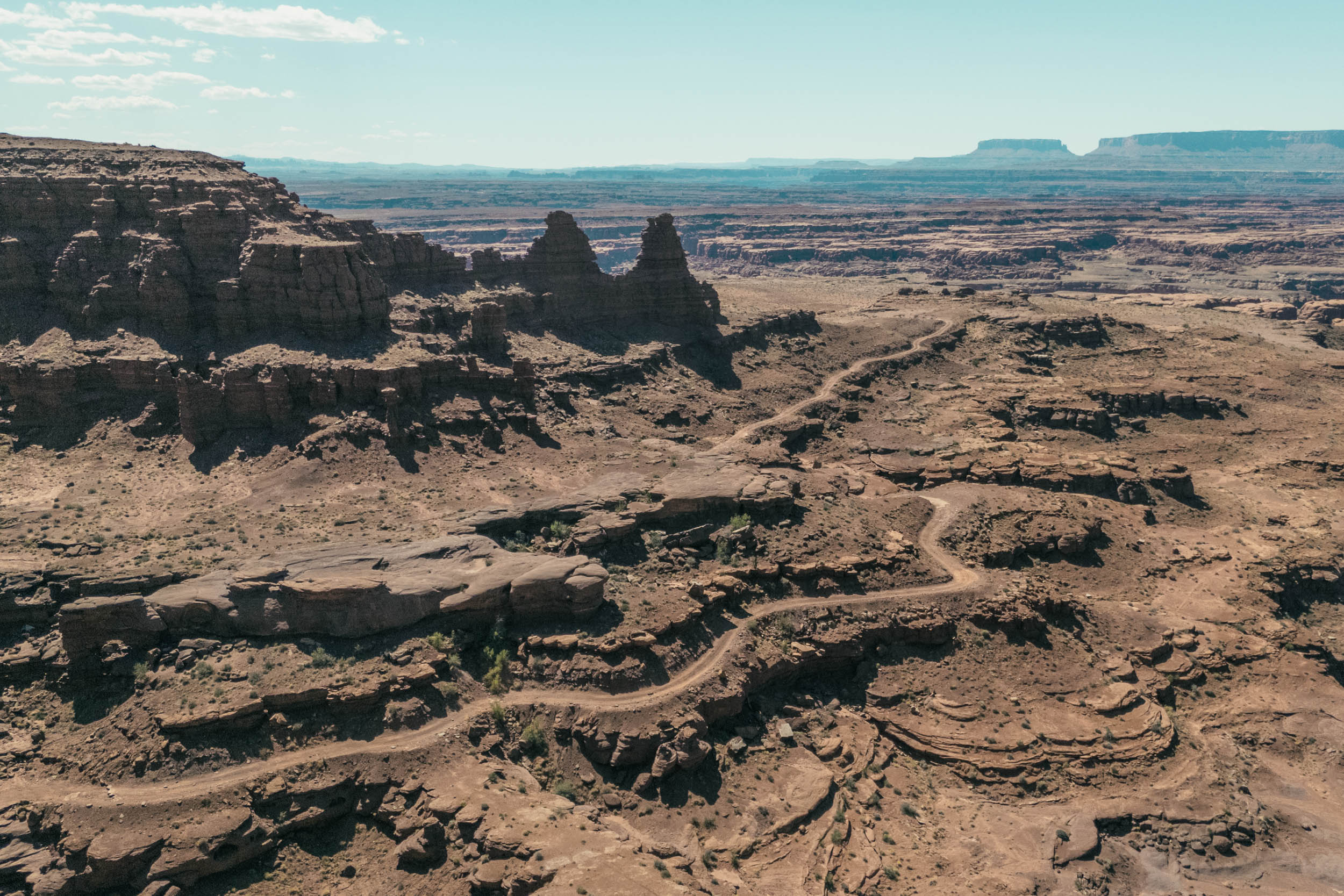
I arrive at the visitor center of Natural Bridges National Monument, top up water (thank god for all the water taps they installed), and move on to the infamous Muley Point for camp. It’s right at the edge of the cliff overlooking Monument Valley. I’m officially back in the desert. There’s no dirt to stake into, so I get to practice the big rock/small rock method for the first time. It’s not my best work, but it surprisingly works.

In the morning, while I have breakfast and coffee, enjoying the views, a middle-aged guy approaches me and asks, “Did you see the fish?” Fish? There’s no water! He takes me to them, and miraculously, in a small pond, there are indeed a bunch of fish. He says they do a sort of hibernation when the water evaporates and “wake up” when the it’s back. Super interesting, this thing called life.
I pack up and head to the infamous Moki Dugway, the switchback descent to the Valley of the Gods. It’s incredibly fun. I overtake cautious cars and trucks and punch through the dirt road. Valley of the Gods is the calmer alternative to Monument Valley, a beautiful and easy loop of about 30 kilometers through the desert and awesome rock formations. After a super enjoyable ride, I finally take to the tarmac and make my way to the town of Mexican Hat, check in to the motel, and have a delicious steak dinner across the street.
This wraps up the Utah section of my tour, as I officially cross into Arizona. It’s been nothing short of a spectacular time. I write in my journal my impressions about this incredibly special place. It’s so quick to humble us with its huge landscapes. Without a doubt, I’ll come back sometime in the future for more exploration. Or just repeat the very same thing, but with a lighter bike. The opportunities are endless!
The Route
Further Reading
Make sure to dig into these related articles for more info...
Please keep the conversation civil, constructive, and inclusive, or your comment will be removed.


 English (US) ·
  French (CA) ·