

PROTECT YOUR DNA WITH QUANTUM TECHNOLOGY
Orgo-Life the new way to the future Advertising by AdpathwayThe River to Clouds Overnighter starts in the heart of one of the United States’ best up-and-coming bike cities. Taking off from central Chattanooga, Tennessee, this short but stout bikepacking route features nearly 35 miles of rolling singletrack, rare ridgeline views, and plenty of places to stop and take it all in…
Special Thanks to Mitchell Connell and Two Bikes Chattanooga
Starting in central Chattanooga near the Walnut Street Bridge, the River to Clouds Overnighter was originally created by Patrick Kelly, the stewardship director at the Lula Lake Land Trust. Much like the Two Bikes Chattanooga bike shop, Patrick has worked to improve bike accessibility around Chattanooga and along its adjacent trails, including those on the River to Clouds route. The route gets its name from its function: it starts near the Tennessee River and extends as far south as Cloudland Canyon Preserve in northern Georgia.
Though many don’t consider places like Chattanooga hotspots for cycling, its current crop of residents, including those involved at conservancies like the Lake Lula Land Trust, are intent on making the city more amenable for cyclists. With hundreds of miles of trails within reach of the city’s existing bike infrastructure, the River to Clouds route offers a perfect example of what’s possible using what’s already available. Along the route, riders follow a mix of bike lanes and dedicated paths, with a clear view of the mountain they’ll be riding along in the distance. Once riders reach the base of Lookout Mountain, the seemingly endless, undulating system of trails inconspicuously carries them across state lines.
The riding varies from fast, easy singletrack to hike-a-bike climbs and short descents that demand a lot of brakes and handling ability. With typical city amenities near the start, refueling points along the route are somewhat sparse as riders head deeper into the sprawling singletrack network along Lookout. That isn’t to say the route is remote, as you’re never too far from a gas station or some form of civilization if necessary, just that the main route keeps users in a beautiful green thicket of classically Southern trees. Northern Georgia is more rural than the route’s starting point, and while there are many opportunities to filter water from creeks and streams, riders should try to pack enough food to last a day. That said, one of the included stops is the Lookout Mountain Pizza Company shop, one of the best dinner options in the area.
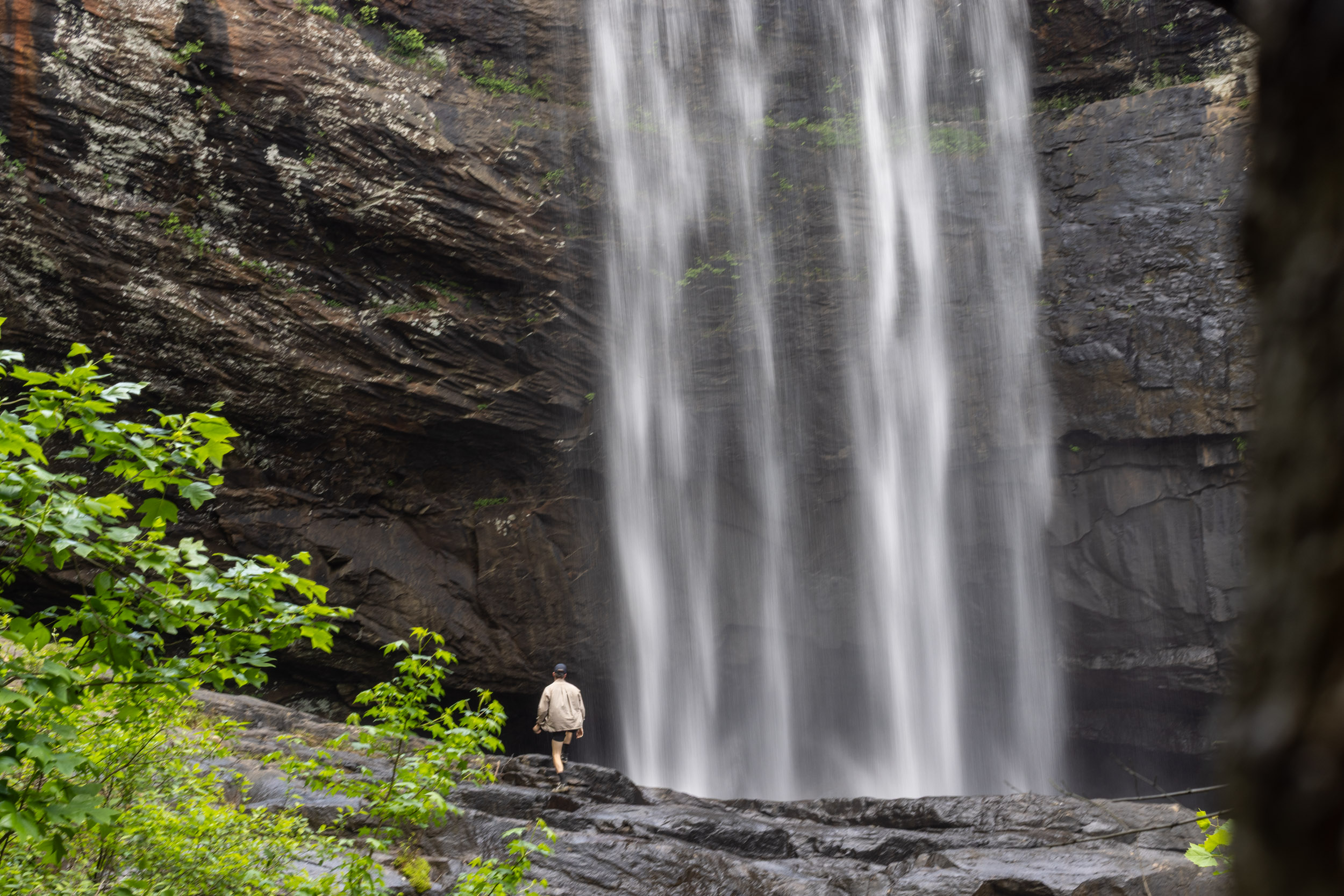
One of the major highlights of the route is stopping at the waterfall near the bottom of Lake Lula Conservancy. Tucked away from prying eyes, this 120-foot waterfall is worth every steep step required to reach it. Almost like being transported back into pre-industrial Appalachia, the waterfall is beset by a massive, square rock formation. If done in the warmer months, visiting this incredible sight is a must.
One element riders should remember is that passing through the conservancy and camping at Cloudland Canyon requires prior permitting. Once the fee is paid, riders are free to respectfully visit the waterfall and camp at Cloudland Canyon’s backcountry campsites. All posted rules should be respected, as this area is shared with pedestrians. A carefully timed ride can include a dip at the waterfall, a bite at the pizza shop, and looking over scenic Cloudland Canyon as the sun sets.
Route Difficulty
Potential riders shouldn’t take the River to Clouds route’s relatively low mileage lightly. Though the ideal would be to split the route in half, averaging roughly 30 miles per day, the terrain is mostly singletrack. These aren’t the most challenging trails in the area, but they demand attention—particularly when fully loaded. Outside of that, the climbs are short and steep. If done during the warmer months, they will test your mettle as the bugs and humidity pick away at your determination. Nevertheless, it’s more than worth it for these rare views.
Bugs and high humidity are part and parcel of outdoor life in the American Southeast. If you’re not used to sweating through your clothing and the all-too-familiar buzzing of mosquitoes, it’s best to consider your willingness to handle it before taking on the River to Clouds route. Relatedly, high humidity and heat create a “wet-bulb” effect, which sucks the body of its necessary moisture. Although it’s entirely possible to ride without packing extra water from the start, the River to Clouds overnighter is a far more enjoyable experience with a water filter.
Given these challenges, the River to Clouds route has a difficulty rating of 5 out of 10. Save for extreme weather events, this route can be ridden year-round, as long as proper permitting is secured.
With regard to technical difficulty, this route is a 5. The singletrack on offer doesn’t have difficult features or too much speed unless you really try to get moving, but the many miles of twisting dirt turns, small rock gardens, and sheer length of singletrack will tire folks out.
The physical demand falls between 4 and 6. Largely dependent on the weather and how oppressive the heat is, the beginning of the route asks a lot of riders’ legs. Between the occasional loose wall that requires summitting to see some of the best parts of the route and the undulating nature of Lower Appalachia, this route will test your climbing and fitness.
Resupplying on the route isn’t difficult on this overnighter, as there are plenty of stores. Even if you run out of the necessities, you’re never too far from some sort of civilization. Gas stations, small grocery stores, and country stores are all along the route, with plenty of access to water throughout. As a result, the rating is a 3.
Route Development: “The River to Clouds Route is the result of nearly two decades of collaboration among land trusts, trail organizations, public agencies, and local advocates working to connect trail systems across Lookout Mountain and the Tennessee Valley. The effort began in 2007 when Lula Lake Land Trust started building the Cloudland Connector Trail System, creating links between its protected lands and Cloudland Canyon State Park. Over the following years, more than 80 miles of purpose-built mountain bike trails were developed across reclaimed mining and timber lands, including the Cloudland Connector, Moonshine, and Durham Mine trail systems.
Parallel to these efforts, the Lookout Mountain Conservancy expanded its own trail system to build a connection from the base of the mountain—where the now-completed Tennessee Riverwalk is located—to the summit, linking directly where LLLT left off with the Moonshine trails. Concurrently, the Chattanooga chapter of the Southern Off-Road Bicycle Association (SORBA) helped secure bicycle access on key sections of trail within the Chickamauga and Chattanooga National Military Park.
As these individual projects grew, opportunities emerged to connect them into a larger network. In 2022, land managers and trail advocates came together to create a unified vision, identity, and information-sharing platform for the interconnected trails. The result was the River to Clouds Route, officially launched in 2023.Today, the 34-mile route links the Tennessee River to the summit of Lookout Mountain, connecting riders to more than 100 miles of trails that showcase the region’s natural beauty, rich history, and ongoing conservation efforts.”
 This route is part of the Local Overnighter Project, which was created to expand our growing list of worldwide bikepacking routes—the first and largest of its kind—and create an independent map and catalog of great bikepacking overnighters, curated by you, from your own backyard. Our goal is to have accessible routes from every town and city in the world. Learn More
Submit Route Alert
As the leading creator and publisher of bikepacking routes, BIKEPACKING.com endeavors to maintain, improve, and advocate for our growing network of bikepacking routes all over the world. As such, our editorial team, route creators, and Route Stewards serve as mediators for route improvements and opportunities for connectivity, conservation, and community growth around these routes. To facilitate these efforts, we rely on our Bikepacking Collective and the greater bikepacking community to call attention to critical issues and opportunities that are discovered while riding these routes. If you have a vital issue or opportunity regarding this route that pertains to one of the subjects below, please let us know:
- The overlook at Cloudland Canyon is a must-see, be it at sunrise or sunset
- Lookout Mountain Pizza Company is undoubtedly the best food on the ride
- Keep an eye out for the stacks of old slag along the singletrack
- Hike down to the bottom of Lula Lake for the incredible waterfall
- There is an extremely steep climb that lets you up onto the Lookout Mountain ridgeline; riders should try to see it
- Starting with Niedlov’s, Velo Coffee, or both is a great way to get going
- Ending the journey with a finishing meal at Lo Mein would be perfect
- Keep your ears peeled at the Cloudland Canyon campsites as the critters and crawlers come alive at night
- Have a conversation with any locals you find; North Georgia is rural and fantastic
- The ideal time for the River to Clouds Overnighter is in the early spring. Temperatures are still cool, greenery has returned to the city, and the foliage is starting to blossom. Target any time from February to May, depending on temperature swings.
- Parking: Chattanooga Area Regional Transportation Authoritaty (CARTA) allows overnight parking in their lots. Rates vary, but it won’t exceed $35. The closest parking to the start is the Renaissance Parking Lot. There are also several bike shops near the start where you could ask about overnight parking.
- Permitting is required for both Lake Lula and camping at Cloudland Canyon. The permits must be acquired before heading out and can be paid for here. Parking in the city can be limited depending on the time of year, but reaching out to Two Bikes Chattanooga or the Land Trust itself could potentially provide a safe location for a vehicle.
- Ticks, chiggers, mosquitoes, and all the potential ills they bring are plentiful on this route, particularly during the warmer months. Be sure to take the necessary precautions if you’re sensitive to bugs.
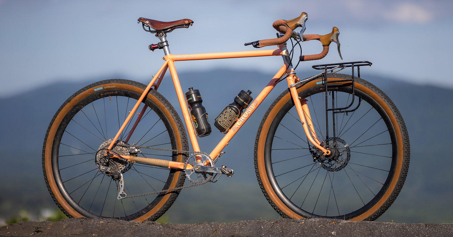
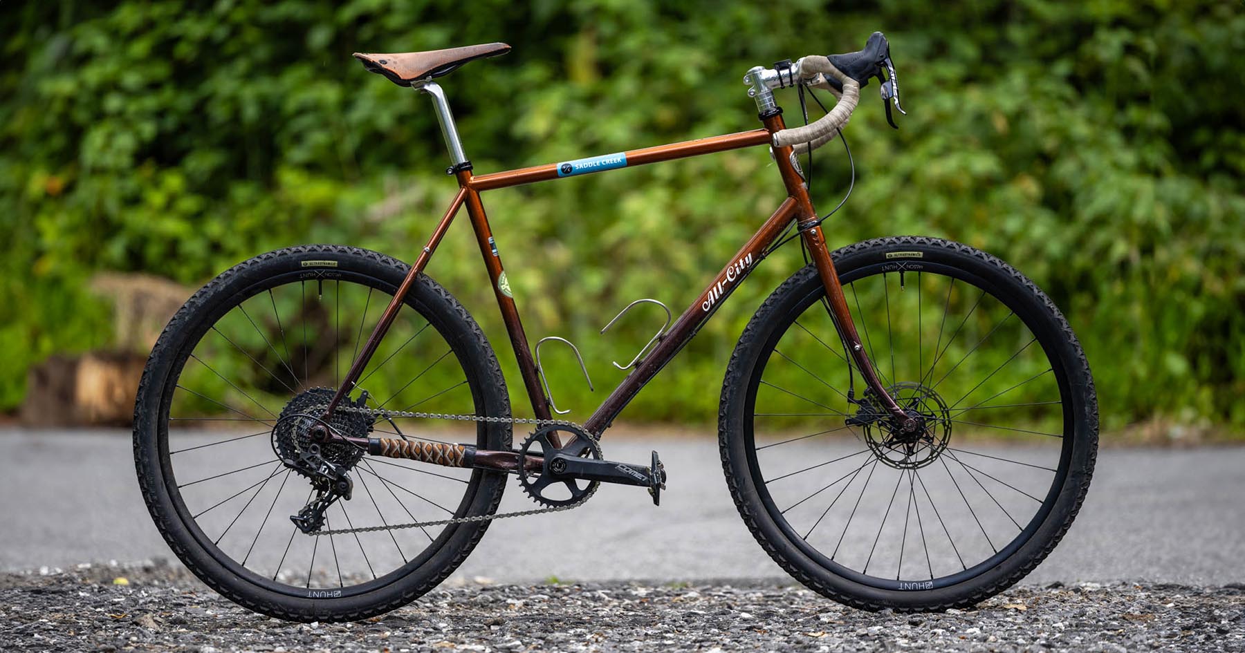
- The two bikes shown in the photoset here were both perfect for the route. If skilled enough, this could even be done on a gravel bike. I rode the Primos Mono ATB with 27.5” x 2.4” tires, but Mitchell was most at ease with his 130mm forked Kona Honzo and 2.6” tires. It’s overkill for some sections, but you’ll have the most fun on the singletrack.
- As stated, all permits to pass through Lula Lake and camp at Cloudland Canyon State Park must be secured prior to embarking on the trip.
- The primitive sites at Cloudland Canyon will vary in access and amenities, but some have access to small creeks where water can be filtered. If you’re without water at your campsite, there are vending machines in the state park.
- Cloudland Canyon State Park also has developed campsites and cabins with more amenities.
- Campsites are dispersed and a five- to ten-minute walk from other amenities, so plan to bring in and pack out all trash and food.
- The route starts in an urban area near a Publix and Whole Foods, bike shops, and all the other amenities you could need right at the outset. Food for the night should be gathered at the start, and the options in central Chattanooga are numerous.
- Once on the singletrack, food stops will be limited. Creeks, streams, and small ponds can all be filtered from, but you won’t have a stop directly on route until much later in the day.
- Lookout Mountain Pizza Company is a must, as are Velo Coffee and Niedlov’s slightly off-route in CHattanooga.
locationDowntown Chattanooga to Cloudland Canyon
Day 1 (45.7 mi +4,368′)
Starting at the Walnut Street Bridge, riders will have plenty of options to stock up on food or get a good meal before rolling. Once ready, riders will follow the Tennessee Riverwalk bike path, passing Erlanger Field and other popular sites. After arriving in St. Elmo, take note: this is the last area where grocery and convenience store supplies are directly on route. Riding through this area is easy, as the bike path is separated from traffic, and climbs onto the Guild-Hardy Trail are via quiet residential roads. Be aware of cars and pedestrians.
Leaving St. Elmo on a steep paved-to-unpaved climb, miles 7-8 mark the start of the dirt portion of the route. Riders will continue climbing and pedaling through undulating terrain and should expect some hike-a-bike in the roughest, steepest portions of the singletrack. No hike-a-bike section is longer than roughly five minutes. Once riders have climbed ~1,500 feet, the singletrack becomes a more gradual up and down. There are fewer rock features, and the terrain gets fast in sections. Riders will pass by streams and creeks and should take the opportunities to filter water if need be.
The remaining 20-30 miles of the day are an absolute joy. Though somewhat remote, they comprise a tangle of seemingly endless singletrack lined with beautiful foliage, the occasional deer, and plenty of shade. Nearly all of the technical riding is shielded from direct sunlight through a thick canopy. It’s a nice, cool break from the sun, even in the hottest parts of the year.
Around mile 45, riders will arrive at Cloudland Canyon State Park. The entrance to the park is straightforward and leads directly to the best view. Revealing a bird’s-eye overlook of the mountain traversed throughout the day, the vista of Lookout is spectacular. From there, riders can find a large board with up-to-date reservations that should include their name, provided they’ve secured the appropriate permits. The name on the reservation corresponds to which backcountry campsite has been reserved. Taking the dirt paths to these sites, mileage will vary, but it should be no more than 10 minutes.
locationCloudland Canyon to Chattanooga
Day 2 (30 mi +1,451′)
After camping at Cloudland Canyon, riders will climb out of the backcountry campsites and onto a rural road, following it north back along the ridgeline of Lookout Mountain. The initial hook that takes riders onto the road leading back to the city has a small gas station/restaurant combo for breakfast, and this stop should be used to stock up on fuel, as resupply points are limited for the next 10-15 miles. Once riders rejoin the rural road headed north, it’s a simple cruise along the shoulder of a quiet backcountry road back toward Chattanooga. On the way, there’s an option to divert onto a steep climb that leads to a high ridge with a view of Lookout Mountain. It’s one of the best in the entire state, but it’s very demanding and unpaved.
The road system then dumps riders back onto a six-mile singletrack section, much like what was ridden the day before. This rejoins the system riders started on and quickly takes them back to the St. Elmo area they climbed out of to reach the initial singletrack. From there, it’s an easy, flat pedal back to the starting parking area with plenty of food and water options along the way.
Terms of Use: As with each bikepacking route guide published on BIKEPACKING.com, should you choose to cycle this route, do so at your own risk. Prior to setting out check current local weather, conditions, and land/road closures. While riding, obey all public and private land use restrictions and rules, carry proper safety and navigational equipment, and of course, follow the #leavenotrace guidelines. The information found herein is simply a planning resource to be used as a point of inspiration in conjunction with your own due-diligence. In spite of the fact that this route, associated GPS track (GPX and maps), and all route guidelines were prepared under diligent research by the specified contributor and/or contributors, the accuracy of such and judgement of the author is not guaranteed. BIKEPACKING.com LLC, its partners, associates, and contributors are in no way liable for personal injury, damage to personal property, or any other such situation that might happen to individual riders cycling or following this route.
Further Riding and Reading
Here are some connected/nearby routes and related reports...
Please keep the conversation civil, constructive, and inclusive, or your comment will be removed.











 English (US) ·
  French (CA) ·