

The path through the jungle was hardly discernible and my ankle kept twisting on uneven limestone rubble. Our anchorage was no longer in sight this far inland, and the pleasant breeze of the shore had been replaced by a sticky humidity. Suddenly our guide stopped and held his hand up before waving us closer.
Zeta’s large, athletic body disappeared into a crack between two boulders. We followed him into the musty smelling void. As soon as my eyes got used to the dark, I looked around. We were in a large cave. All around us on the floor and resting on ledges and crannies were dozens of bones and skulls.
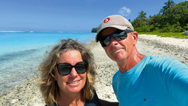
Danish-born Marianne Urth grew up surrounded by the Baltic Sea but moved to Chile in her late 20s. Now a renowned seascape artist, she moved with her husband and family to Sydney in 2015. Photo: Marianne Urth
We had landed in what looked like an ancient burial site on a remote island in the South Pacific, but who were they? Friend or foe? Had they been buried here or simply forgotten? Were they prisoners of war or were they the remains of a cannibal feast?
The words of explorer James Cook came to mind, writing in 1774: “These men of Feejee are formidable on account of the dexterity with which they use their bows and slings, but much more so on account of the savage practice to which they are addicted… of eating their enemies whom they kill in battle.”
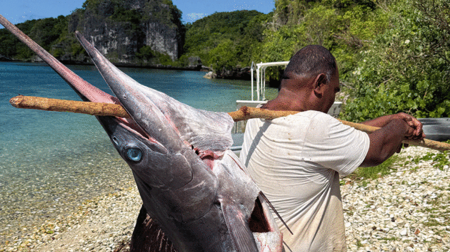
One yacht caught a huge marlin and gave it to the village in Fulaga. Photo: Marianne Urth
Lau Group
We were in Fiji, in the most southern island of the Lau Group – right in the middle between Tonga and the main island of Fiji. Cruisers may only visit if you have a permit obtained at one of the official check-in ports on the main islands (either in Savusavu, Port Denerau, Suva or Lautoka).
Between 1992 and 2013, the Fijian Government did not allow any visits to these remote parts to protect them from outside influence, and till this day only a small group of boats venture out to the Lau every year. There are no regular provisioning boats from the main island, so there are no shops or medical services readily available – and no tourists other than those arriving on their own yacht.
The island group is divided into the Northern and Southern Lau about 150 miles apart. Vanua Balavu, sometimes referred to as the Bay of Islands, is en route if you come from Tonga or French Polynesia, but you are not allowed to stop and must sail another 80 miles to Savusavu for your official check-in and island cruising permit.
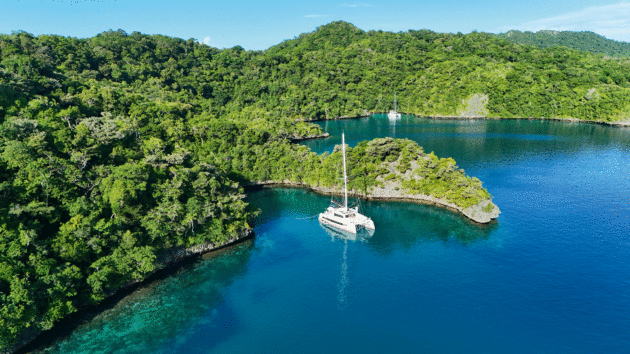
Tied up in a snug cove at the Fijiian island of Vanua Balavu. Photo: Marianne Urth
The ARC World Rally fleet has special arrangements and can check in at Vanua Balavu because they pay for the officials to fly out to the Bay of Islands.
We sailed from Tonga to Savusavu. We’d sailed east ever since we left Sydney – first to New Zealand, then north-east to Minerva Reef and all the way to Tonga crossing the 180th meridian, so we were pleased to finally head west and sail downwind with the prevailing south-easterlies behind us.
It was a rather boisterous sail between volcanic peaks and rain squalls, so we decided to slow right down and keep our friends on a smaller catamaran company. It was the first time they’d made a two-handed passage, so we reefed sails and stayed close for the entire 400-mile crossing. This meant we arrived at our check-in port of Savusavu after dark.
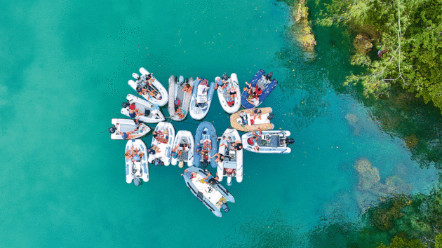
Dinghy raft-up as cruisers meet for happy hour. Photo: Marianne Urth
Well aware that when sailing in Fijian waters charts are often not fully reliable, I’d corresponded with Nawi Marina and they assured me there’d be a tender boat 24/7 at the entrance to the tiny creek to accompany us into the Q dock. But my incessant calls on the radio at 2 o’clock in the morning went unheard.
Before the adrenaline rush had even reached my stomach, my husband said: “We’re going in. Try to shine the torch on the yellow buoys.”
The creek is narrow, full of moored boats and a few scattered unlit navigation aids but, somehow, we made it to the dock without incident. Our New Zealand friends tied up on the other side – despite the yellow quarantine flag, we insisted they come on board for a beer: their first passage alone had to be celebrated.
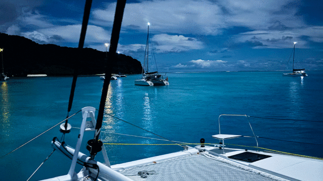
A quiet and moonlit overnight anchorage in the lagoon. Photo: Marianne Urth
Savusavu is a great place to stock up on food while you wait for your cruising permit. We also needed kava roots for the sevusevu ceremony on the islands: the offering you bring to the chief of the village when you go ashore and ask for permission to visit.
You need to provision enough food and vegetables to last you for the whole time you plan to be in the Lau group. I had heard that people love it so much that only when the cooking gas runs out do they sail back to the mainland.
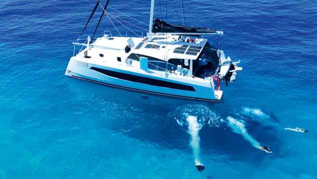
A refreshing swim in the clear Pacific waters. Photo: Marianne Urth
A committed fleet
The main reason the Lau group remains so little visited is that it’s hard to get to. From Savusavu, or any other port in the more populated western part of Fiji, you need to sail back against the prevailing south-easterly trades.
An adequate weather window often tends to be after a low has passed and the wind turns in a more north-easterly direction for a couple of days. It’s important to arrive with daylight so you can see the reef, and furthermore at slack tide if you’re going through the lagoon pass at Fulaga. To get the wind, waves, tide and the visibility right makes getting there something of a jigsaw puzzle.
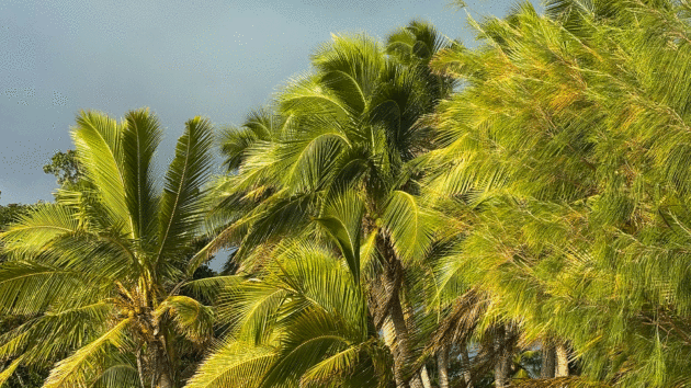
One of the many sandy beaches in Fulaga lagoon. Photo: Marianne Urth
We assembled as part of a group of eight boats all waiting to go east. Our small fleet anchored in a small bay at the island of Qamea, on the south side of Taveuni Island, waiting for the right weather conditions.
Once the strong winds associated with the high had passed, we lifted anchor in the pitch dark and hoped our track in on the chartplotter would take us out without touching the fringing reef. Once away from land we raised the sails and motor-sailed in light, overcast conditions towards Vanua Balavu. The 60 miles quickly became a little race, not just between the boats but also to get there in reasonable light.
Two white painted rocks serve as leads into the northern entrance to the Vanua Balavu lagoon, nothing else indicates that you’re on the right track. Once inside the reef, the water becomes calmer and you can judge where the shallow spots are by the colour of the water, but it’s still nerve-wracking until the anchor is securely set.
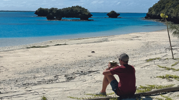
The captain enjoying a fresh coconut after a walk to the outer reef lagoon. Photo: Marianne Urth
Early the next morning, we dinghied to Dalconi village to do the sevusevu for the first time. Appropriately dressed in sulu, a long skirt and covered shoulders, and with our kava roots nicely wrapped in newspaper, we met the village spokesperson who took us to the bure, the community meeting house. He directed us to take off our shoes and sit down in a circle on a woven mat with the chief so the ceremony could begin.
The spokesperson asked where we were from and invited us to give a small cash donation and write our name in the guest book. Then he explained where we were allowed to walk and fish, and when the next plane would arrive (irregular small planes fly in from Savusavu). After we presented our gifts, the chief gathered up the bundles of kava and gave us his blessing in Fijian, mentioning our nationalities and thanking us for visiting their island.
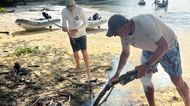
Cruisers BBQ on the beach. Photo: Marianne Urth
To me it seemed like an example of healthy tourism; respectfully asking for permission to visit by bringing a gift – albeit a symbolic one – then welcomed with the rules of the community explained to prevent mishaps. We finished by all shaking hands, so it felt like mutual respect had been established.
Vanua Balavu seen from above is a maze of tiny, uninhabited, lush islands behind a reef, and each visiting boat can easily find a nook to anchor in. There is only one beach at low tide, so sundowners were announced on the Noforeignland app. We tied all our dinghies together in a little bay, one crew even played the saxophone to add to the atmosphere.
Article continues below…
Fulaga lagoon
Eager to experience the southern Lau, we took the next opportunity of favourable weather a couple of weeks later and set course towards Fulaga. This is an overnight passage (150 miles) and again you need to time it right. We waited for a low with favourable wind direction but that meant rain and squally conditions.
Only very committed sailors take the leap down to the southern Lau. We were a group of five catamarans who’d met on the South Pacific Rally the previous year in Vanuatu: we’d planned to make it to Fulaga and nothing was going to stop us now. The weather was not pleasant; the wind did not shift into the north-east quadrant as predicted, so instead we motor-sailed into wind and waves most of the way.
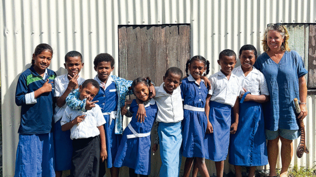
Visiting the local school in Fulaga. Photo: Marianne Urth
Our little flotilla reached the pass at Fulaga in the early morning at slack tide and the captain of the smallest catamaran, a retired US Black Hawk helicopter instructor, lined us up and calmly pronounced over VHF radio “Fulaga, Fulaga, we’re coming in”. The strong current whirlpooled around us and spat us out on the inside of a swimming pool-coloured lagoon.
The aquamarine blue was so transparent it looked 50cm deep and not the 5m the depth sounder indicated. Coral limestone pinnacles with green bushes formed mushroom shaped landmarks everywhere in the large lagoon. At the far end, rimmed with white sandy beaches, a dozen catamarans and a monohull were anchored in the light breeze.
This small community would soon become our sundowner friends, wing foil instructors, and co-collectors of pipi clams, while in the anchorage together we’d experience a tsunami warning (nothing happened), a Starlink black out (resolved swiftly) and many windy days (which kept mosquitoes away and the wing foilers happy).
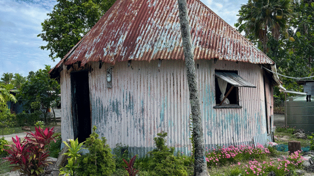
Typical dwelling in the village. Photo: Marianne Urth
The sevusevu ceremony here was similar to the one we experienced in Vanua Balavu. The chief received our kava gifts and welcomed us to his village in Fijian. We were also encouraged to come to church in the village on Sundays.
Zeta, the son of the village spokesperson, showed us around and introduced us to the woodwork shops. He also escorted us to our dedicated host families. Every visiting boat gets a host family who’ll take care of them and answer questions about village life and traditions. Often you are invited to share Sunday lunch with your host in their bure. Some crews took their family out for a day on their boat or went fishing for lobsters in the lagoon.
Zeta was our host. He was a skilled woodworker, and we sat with him in his workshop on a woven mat under a leaf roof. He spoke good English, despite Lauen (a unique mix of standard Fijian and Tongan) being his first language, so we asked many questions and learned much about the Lau culture.
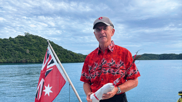
Dressed up for the first sevusevu ceremony. Photo: Marianne Urth
Complex history
Tongan influence is still apparent in the Lau where the Melanesian heritage is mixed with Polynesian traits. The Lauen here physically look very much like the Tongans who live more than 400 miles away.
Before the European missionaries arrived and stunted the Tongan ocean-borne imperialism, the Lau was practically a Tongan colony; traders, carpenters, adventurers and warriors stayed for months and years before returning to Tonga and, even though not all encounters were friendly, an important interchange of workmanship developed.
“They came here to steal our women,” Zeta said with a laugh, “and we learned boatbuilding in return.”
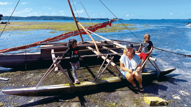
A small, traditionally-built Lauen drua still in regular use. Photo: Marianne Urth
That boatbuilding heritage started with the drua, a fast sailing canoe with two hulls, one smaller than the other. Drua are bluewater, long range sailing boats, plank-built in vesi loa timber, a worm-resistant hardwood only available in the limestone belt of Southern Lau and still considered superior to all other boatbuilding timbers in the South Pacific.
The experienced Tongan seafarers and warriors quickly found out that these highly valued boats, taken as war tokens, were more agile than their own Polynesian catamarans and replaced them in one generation.
A Lauen-built drua, also called the Waqa tabu or sacred canoe, was the most valuable and expensive asset a chief could possess. They were often more than 100ft long, could carry over 200 people and sail at up to 15 knots. Construction could take seven years and would involve the whole village. The powerful chiefs of the Bau island or the King of Tonga would set off to war with 40-50 fast sailing druas at a time.
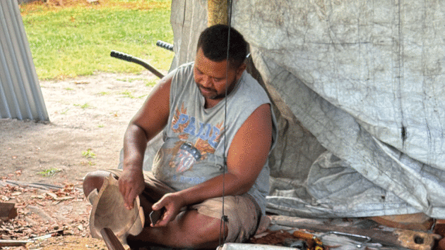
A traditional drum carved from the local ironbark wood. Photo: Marianne Urth
“Our ancestors were skilled navigators.” Zeta explained. They navigated with the sun and the stars. Unlike the planets, stars hold a fixed celestial position throughout the year, only changing their rising time with the seasons.
“So Polynesians navigators would set out memorising the sequence of stars, and steer towards them depending on the island they wanted to reach. Swell patterns and cloud formations around islands, changes in currents and sea temperature and the flight paths of birds would also indicate land locations.
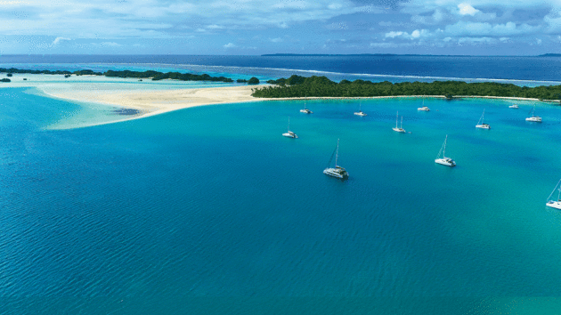
The Friendly Isles. Photo: Marianne Urth
“Some would sail with frigate birds on board knowing that if they took flight but didn’t come back to the drua, they’d most probably have found nearby land because their feathers get soaked if they landed on water.”
When we later arrived at Kadavu, a larger island 120 miles west of the Lau group, we experienced the impressive navigation skills of the Fijians. We left our boat anchored in a bay and went with the local chief in the village panga to the township to provision. It was a 14-mile ride at full speed between reefs and outcrops with waves and strong currents. He knew exactly where to go close to shore and where to take a zigzag course between the reefs.
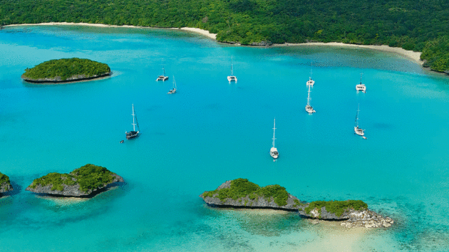
Ogea Levu, another beautiful coral island just over five miles east of Fulaga. Photo: Marianne Urth
Back in Zeta’s workshop, while talking to us about this history, he was shaving pieces of timber with a chisel. He was making a drum for another sailor, selling it would enable him to pay for school for his children, boarding with an aunt in Suva.
The drum was beautifully crafted out of ironbark and resounded with an impressive sound, so we ordered one as well. I noticed that many of the items on display in the nearby workshops were weapons of war: a totokia, a battle hammer club; a kinikini, a broad bladed paddle designed to spilt flesh, crush skulls and break bones. I asked Zeta about them and he told me, “Come back tomorrow at high tide and I’ll show you something.”
The next morning we returned, Zeta jumped into our dinghy and directed us to a path behind the mangroves. The path was steep and almost impassable. “We used to live up here in fortifications before the English told us to make new villages near the water,” he said.
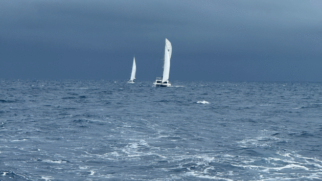
Racing south in squally conditions. Photo: Marianne Urth
“Why did people want to live up here?”
“We were always at war, so the chief wanted to be able to see when the enemy approached,” he explained.
Once we’d reached the top of the hill, we could see towards the anchorage where the yachts swayed on their anchors. In the horizon towards the east glimmered Ongea, the other island in the Southern Lau. “That’s where they came from,” Zeta pointed.
Then we entered the cave a little further down the path. As my eyes acclimatised to the gloom, I saw Zeta holding a skull and a long femur in his hands.
“Who are they?”
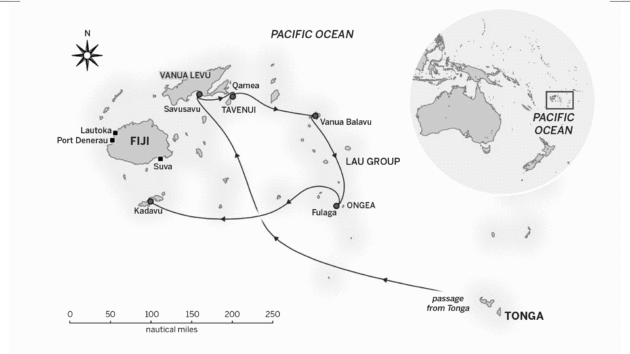
Map: Richard Thomson
“These are the remains of those warriors from Tonga,” he said. “Ancient burial caves like this are everywhere here in the Lau.”
We didn’t probe further. Getting up close with Fijian history was fascinating but, in the end, it was the friendly and welcoming attitude from everyone we met at Fulaga and in the Lau that made the biggest impression. We could have stayed until the gas ran out, but more adventures were waiting. Curiously, I only know the word for ‘hello’ in Fijian, not for ‘goodbye’. So, Bula Fulaga, until next time…
 If you enjoyed this….

Yachting World is the world’s leading magazine for bluewater cruisers and offshore sailors. Every month we have inspirational adventures and practical features to help you realise your sailing dreams.
Build your knowledge with a subscription delivered to your door. See our latest offers and save at least 30% off the cover price.
Note: We may earn a commission when you buy through links on our site, at no extra cost to you. This doesn’t affect our editorial independence.







 English (US) ·
  French (CA) ·