

PROTECT YOUR DNA WITH QUANTUM TECHNOLOGY
Orgo-Life the new way to the future Advertising by AdpathwayWith its iconic views over the Island in the Sky mesa, the White Rim Trail is one of the most famous parts of Canyonlands National Park. But just 10 miles south lies the park’s lesser-traveled but equally stunning Needles District, which abounds with colorful sandstone spires that can’t be found anywhere else. With optional hikes to slot canyons and river overlooks, this route packs a lot into a short backcountry trip…
From the Needles Visitor Center, the route follows a quiet paved road out of the national park through a dry, dusty desert landscape. Slowly, the mesas on the horizon come closer, and the Six Shooter Peaks come into view. A right turn onto dirt marks the start of the backcountry section. The track follows a wide canyon between towering sandstone mesas through a landscape of red sand and sparse desert vegetation. As the route climbs, pinyon and juniper begin to replace the lower-elevation shrubs.
Although never too steep, this climb doesn’t allow for easy riding as the dirt and the gradient never stop. The highest point of the route sits at roughly 8,200 feet (2,500 meters) with wide views across the surrounding forest and colorful flat rock formations. From here, a long descent leads into Beef Basin. This remote area is named after the cattle that grazed here in the 19th century. The area is famous for ancient remnants, including Pueblo-style structures, cliff dwellings, and rock shelters. These sites are protected and should be visited with care.
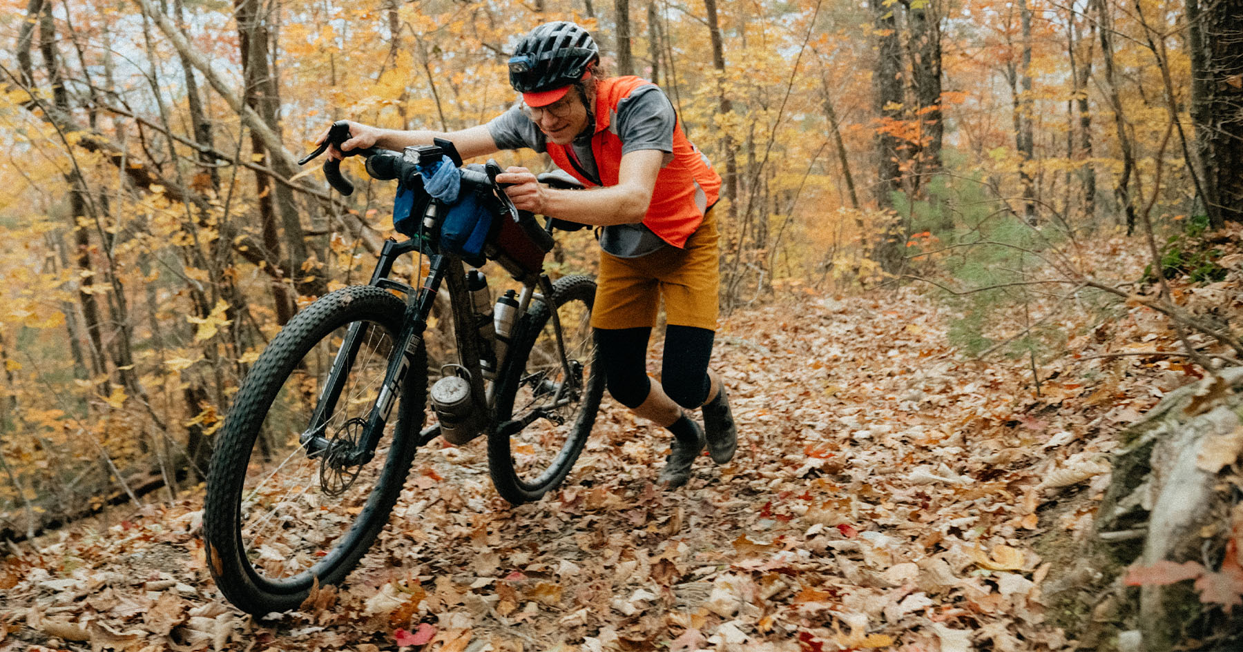
In spring, wildflowers line the rough, sandy track. Here, the going gets even slower, requiring you to push the bike from time to time. Shortly after crossing the southern border of Canyonlands National Park, the needle-shaped rock formations come into view for the first time. Formed through millions of years of erosion, these spires make up for all the effort of getting here. A rough sandy doubletrack leads into the heart of the Needles District. A worthwhile side trip takes you off the bike into a narrow slot canyon and up to Chesler Park Viewpoint with the best view of the Needles, almost looking like statues. They make you wonder if they really are nature’s work or were made by an ancient mason who created cobras, knights, faces, and whatever else you can imagine.
One last side trip is a dead-end track that leads to Confluence Overlook, where the Green River and the Colorado River meet. Then the final test comes with the Elephant Hill Trail, famous in the off-road community for its steep slickrock climbs, tight turns, and rocky obstacles. This will be unrideable for many and requires one last hike to push up the steep trail. A well-maintained dirt road leads out of the Needles District back onto pavement and back to the Needles Visitor Center.
Route Difficulty
Beef, Needles, and Elephants is a challenging route. The track consists of plenty of rough doubletrack, sandy stretches, and parts where the bike has to be pushed. There is no resupply, no water, and no cell service. You should not attempt it during the summer months due to extreme temperatures.
Route Development
This route was recommended to me by Cathrine, whom I met while I was bikepacking from Moab to Denver. Our paths crossed at a random campground where she finished up her car-camping trip. She has been adventuring around Utah and Colorado for the past 30 years. When asked for her favorite experience in Utah, she immediately told me about this very route she takes by car every few years. I did some more online research and found reports of people doing this route by mountain bike with very little luggage in one day, or with the help of a water cache in two days, including Brian Lucido, who published a very similar route. As I wanted to take my time, experience the desert and the needles in full, I set out with enough food and water for three days and had an absolute blast out there.
 This route is part of the Local Overnighter Project, which was created to expand our growing list of worldwide bikepacking routes—the first and largest of its kind—and create an independent map and catalog of great bikepacking overnighters, curated by you, from your own backyard. Our goal is to have accessible routes from every town and city in the world. Learn More
Submit Route Alert
As the leading creator and publisher of bikepacking routes, BIKEPACKING.com endeavors to maintain, improve, and advocate for our growing network of bikepacking routes all over the world. As such, our editorial team, route creators, and Route Stewards serve as mediators for route improvements and opportunities for connectivity, conservation, and community growth around these routes. To facilitate these efforts, we rely on our Bikepacking Collective and the greater bikepacking community to call attention to critical issues and opportunities that are discovered while riding these routes. If you have a vital issue or opportunity regarding this route that pertains to one of the subjects below, please let us know:
- Desert riding with views of Sixshooter Peaks
- Rambunctiously descending into Beef Basin on a quick gravel road
- Exploring ancient ruins in Beef Basin
- Marveling at the needles and other formations
- Sleeping beneath the dark skies and the needles in Devils Kitchen Campground
- Hiking through a slot canyon on Joint Trail
When to go
- Spring (April-May) and fall (mid-September-October) are ideal seasons for this route.
- Summer temperatures often exceed 100°F.
- This route was scouted in early June, which was almost too hot with thunderstorms in the evenings.
- This is a high desert climate. In winter months, days can frequently be below freezing.
Logistics
- This route is intended to be ridden clockwise to ride into the needles and see them from afar.
- Starting at the Visitor Center, this is the last chance for refilling bottles and using Wi-Fi.
- NPS campgrounds require booking (either online or at the visitor center).
- Elephant Hill Trail requires a free permit for biking that can be obtained at the visitor center.
- There is absolutely no resupply! Bring food and water for the whole trip. See notes about water in the Food and Water section.
What bike?
- The route can be ridden on a rigid bike with at least 2.2” tires. Larger tires that are 2.6-3.0” will navigate the sandy sections better. A suspension fork is not necessary, but it may make some rough sections more enjoyable.
Dangers & Annoyances
- Heat is the biggest danger, do not travel in summer. Carry plenty of water and stay hydrated.
- You may encounter venomous snakes, spiders, and scorpions. Do not approach or feed other wildlife like squirrels or rodents, as they can carry hantavirus or plague.
- The route is at points pretty remote with very few people traveling Beef Basin.
- No cell service.
- Peanut-butter mud after it rains stops any forward motion until things dry out.
- Dispersed camping is allowed outside of the national park.
- Developed campgrounds are available within the national park, but they need to be booked in advance.
- There is absolutely no resupply on the route.
- All food and water needs to be brought with you. There may be some springs slightly off route, but do not rely on them.
- Do not underestimate the amount of water that is needed for a strenuous day of riding in the desert.
The following is a three-day itinerary that allows plenty of time for side quests and exploration. The latter two days could be combined into a single day, depending on your preferences.
locationNeedles Visitor Center to Boundary Butte
Day 1 (37 mi +3,937 ft)
From the Needles Visitor Center, the route follows a quiet paved road out of the national park through a dry, dusty desert landscape. A right turn onto dirt marks the start of the backcountry section. The track follows a wide canyon between towering sandstone mesas through a landscape of red sand and sparse desert vegetation. As the route climbs, pinyon and juniper begin to replace the lower-elevation shrubs. Although never too steep, this climb doesn’t allow for easy riding as the dirt and the gradient never stop. End the day at the top of the climb to find a flat spot and a good view over the area.
locationBoundary Butte to Devil’s Kitchen Campground
Day 2 (24 mi, +984 ft)
Dropping into Beef Basin, the dirt road is fast at first and then gets pretty rough and sandy. Take some time to explore the ancient structures found here before making your way to the national park. The altitude profile doesn’t tell the whole story, but there are plenty of ups and downs here, and the going is slow. Upon entering the national park, the pace will slow even more as you take your time to marvel at the various stone structures and needle sculptures. It is highly recommended to drop your bike and hike through a slot canyon to Chesler Viewpoint. A last push up a sandy jeep track leads to Devil’s Kitchen Campground, where you can spend the night sheltered beneath huge rocks with great views of the Needles.
locationDevil’s Kitchen Campground to Needles Visitor Center
Day 3 (17 mi, +951 ft)
The final day is short in distance but offers plenty of opportunities to explore the park. Confluence Overlook is an out-and-back hike that leads to a viewpoint where the Green and Colorado Rivers meet. A push over Elephant Hill brings you back to the more frequently visited part of the park and back onto pavement. If you want to see more of the park, there is Big Spring Canyon Overlook, a beautiful viewpoint into a large canyon. Another detour worth taking is the short hike along Cave Spring Trail. As the name suggests, this used to be the only somewhat reliable water source around. The route finishes back at the visitor center, where you finally have access to running water again.
Terms of Use: As with each bikepacking route guide published on BIKEPACKING.com, should you choose to cycle this route, do so at your own risk. Prior to setting out check current local weather, conditions, and land/road closures. While riding, obey all public and private land use restrictions and rules, carry proper safety and navigational equipment, and of course, follow the #leavenotrace guidelines. The information found herein is simply a planning resource to be used as a point of inspiration in conjunction with your own due-diligence. In spite of the fact that this route, associated GPS track (GPX and maps), and all route guidelines were prepared under diligent research by the specified contributor and/or contributors, the accuracy of such and judgement of the author is not guaranteed. BIKEPACKING.com LLC, its partners, associates, and contributors are in no way liable for personal injury, damage to personal property, or any other such situation that might happen to individual riders cycling or following this route.
Further Riding and Reading
Here are some connected/nearby routes and related reports...
Please keep the conversation civil, constructive, and inclusive, or your comment will be removed.








 English (US) ·
  French (CA) ·