
PROTECT YOUR DNA WITH QUANTUM TECHNOLOGY
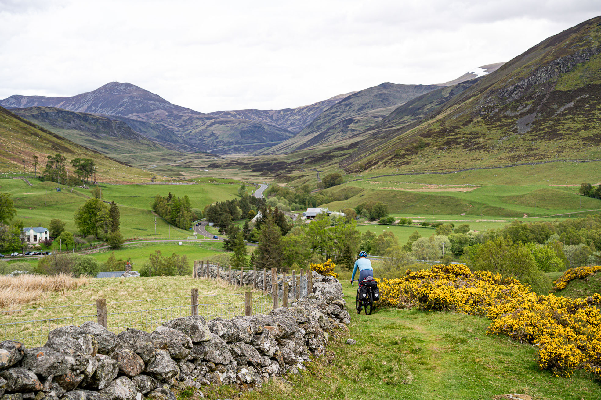
Orgo-Life the new way to the future Advertising by AdpathwayThe Abitibi‑Temiscamingue Odyssey is a family‑friendly bikepacking loop through northern Québec’s vast, lake‑dotted boreal wilderness. It links remote communities, local markets, and quiet roads with a playful spirit of treasure hunting. Equal parts endurance ride, cultural deep dive, and scavenger quest, this route invites riders to slow down, look closer, and enjoy the unexpected, which may include a fox, a bear, or a moose…
The Abitibi-Témiscamingue Odyssey is less about chasing summits and more about chasing stories. Spanning a territory roughly the size of Ireland—but with very few people and countless lakes—this long-form bikepacking loop rewards curiosity, patience, and a sense of humor. It’s a ride where distance matters, but where what you notice along the way matters even more.
The route intentionally favors secondary roads that stitch together forests, farmland, and lakeshore camps. Busy highways are largely avoided, making the Odyssey accessible to a wide range of riders, including families. While the terrain is generally rolling rather than mountainous, the sheer scale of Abitibi-Témiscamingue turns the ride into a proper journey—one that unfolds slowly, day after day, as horizons open and communities become meaningful milestones.
Abitibi-Témiscamingue is a region shaped by water, forests, and successive cycles of use that guided its settlement. Long before roads or railways, it was the ancestral territory of the Anishinaabeg, whose lives revolved around rivers, lakes, portage routes, fishing, hunting, trapping, and canoe travel. Several Anishinaabeg communities continue to anchor the region today, including Abitibiwinni, Timiskaming, and Long Point First Nation, maintaining a deep connection to the land and waterways that still define the route.
Towns along the Odyssey reflect this layered history. Ville-Marie, the oldest town in the region, was founded in 1886 along the shores of Lake Témiscamingue, near one of the earliest and most important fur-trading corridors in northwestern Québec. Its position recalls an era when travel and exchange were shaped by canoes and waterways rather than roads. Farther north, Amos emerged as an agricultural and administrative center that anchored regional settlement, while La Sarre reflects the expansion of forestry and cleared farmland. Rouyn-Noranda and Val-d’Or were born from the gold and copper rushes of the 1920s and 1930s, forging an industrial identity that remains present in their landscapes and working culture today.
What truly defines the Odyssey, however, is its playful treasure-hunt spirit. Rather than ticking off iconic landmarks, riders are invited to seek out regional curiosities: covered bridges, roadside relics, unexpected viewpoints, community murals, quietly heroic snack bars, and fragments of local lore. Ville-Marie offers a particularly memorable chapter, featuring stories rooted in Lake Témiscamingue, including a legendary lake creature seen by many over the years but never caught. Once overfished, the sturgeon is now protected and emblematic, symbolizing both the fragility and resilience of local ecosystems.
Food becomes part of the hunt as well. Small markets, bakeries, fromageries, and farm stands appear at irregular intervals, rewarding riders who plan carefully—or who simply arrive hungry at the right moment. Conceived and ridden as a family adventure with children and a dog, the Abitibi-Témiscamingue Odyssey ultimately shows that meaningful exploration doesn’t require extreme terrain—just curiosity, time, and a willingness to see familiar places as if they were full of secrets.
Route Difficulty
Overall, we rate this route a 4 out of 10. The route primarily uses paved and gravel roads with minimal technical riding. It’s suitable for confident road and gravel riders. Elevation gain is modest, but long distances, frequent headwinds, and consecutive riding days make this a steady endurance challenge. However, towns are far apart, and services can be limited or seasonal. Riders must plan food and water carefully, which adds to the adventure.
Route Development: The Abitibi‑Témiscamingue Odyssey emerged after riding established regional loops elsewhere in Québec and asking the simple question, “Why not here?” Inspired by routes like La Véloroute des Bleuets and adventure-based bikepacking routes in British Columbia that weave in hidden landmarks, photo challenges, and a sense of treasure hunting, the Odyssey was developed using a mix of digital mapping and deep local knowledge. Familiarity with Rouyn‑Noranda, Val-d’Or, and Ville‑Marie helped identify quiet roads, reliable connectors, and rewarding detours.
Rather than chasing technical difficulty, the focus was on cohesion, accessibility, and storytelling—creating a loop that invites riders to engage with the region, its people, and its small details. We’ve added a suggested scavenger hunt in the “Trail Notes” section as well!
Submit Route Alert
As the leading creator and publisher of bikepacking routes, BIKEPACKING.com endeavors to maintain, improve, and advocate for our growing network of bikepacking routes all over the world. As such, our editorial team, route creators, and Route Stewards serve as mediators for route improvements and opportunities for connectivity, conservation, and community growth around these routes. To facilitate these efforts, we rely on our Bikepacking Collective and the greater bikepacking community to call attention to critical issues and opportunities that are discovered while riding these routes. If you have a vital issue or opportunity regarding this route that pertains to one of the subjects below, please let us know:
- Repeated access to lakeside camping, swimming, and relaxed evenings by the water, including Mont-Vidéo, Lac Courval, Roquemaure Beach along Lake Abitibi, Lac Simard, and numerous informal lakeshore stops that invite spontaneous swims, sunset dinners, and quiet nights near the water.
- Striking geological features shaped by glacial history, most notably La Montagne à Fred, a former island of the ancient Ojibway–Barlow glacial sea. The site features exposed rock caps, wind-shaped pines, and a distinctive “river of stones” that offers a short, memorable hike and a tangible sense of the region’s deep geological past.
- Historic rural heritage woven throughout the route, including covered bridges such as Levasseur Bridge (1928) and Leclerc Bridge (1927), the École du Rang II in Authier, and small agricultural villages where rang roads and cleared fields tell the story of settlement.
- A rich and varied food landscape highlighting regional products, with multiple fromageries (La Vache à Maillotte, Fromabitibi, Fromage au Village), local butcher shops, farm stands like Les Potagers du Pouce Vert, artisan bakeries, and classic casse-croûtes serving some of the region’s most beloved poutines.
- La Sarre as a gastronomic and cultural anchor in Abitibi-Ouest, featuring local food producers, butcher shops, a microbrewery, and nearby covered bridges set within landscapes shaped by forestry and agriculture.
- Amos, offering access to the Harricana River, Le Refuge Pageau, the arboretum of Trécesson, a cathedral, and full rider services.
- A lively urban interlude in Rouyn-Noranda, where cafés, microbreweries, bookstores, pottery studios, observation towers, beaches, museums, and mountain-bike trails provide cultural depth and a mid-route reset.
- Ville-Marie, the oldest town in the region (founded in 1886), located on Lake Témiscamingue and known for its lakeside parks, historic sites, orchards, chocolatiers, graffiti caves, renowned poutine stops, and stories tied to a legendary lake creature.
- Angliers and the Ligne du Mocassin corridor, following a former railway line through cliffs, rivers, rapids, waterfalls, and hydro-electric infrastructure that reveal the region’s transportation and logging history.
- Val-d’Or as both the starting and finishing hub, showcasing Abitibi’s mining heritage at La Cité de l’Or, forest recreation areas with mountain bike trails, cafes, distilleries, public markets, and bike shops that bring the loop to a celebratory close.
- A playful treasure hunt spirit that runs throughout the Odyssey, encouraging riders to collect small, meaningful discoveries such as murals, roadside relics, unexpected viewpoints, memorable snacks, and conversations rarely found on traditional cycling routes.
When to go:
- The route is best ridden from June to September. The best time to ride the route is really August through September, when temperatures are still warm, conditions are generally more stable, and insects are much less present.
- Because of the northern latitude, daylight hours are very long during the summer. Temperatures can also vary significantly—for example, it can be around 8°C at night and reach 30°C during the day.
- Around the summer solstice, daylight is especially extended, with sunset often occurring close to 10–10:30 p.m., which means it can still feel like full daylight quite late in the evening.
- There is not really a defined rainy season in Abitibi-Témiscamingue, although July and August tend to be slightly wetter overall. Snow can also remain in shaded forest sections until mid to late May, depending on the year and trail conditions.
Logistics:
- Expect long distances between services and be able to carry extra food and water.
- Check itinerary beforehand (for road and bridge construction closures).
- You will have access to natural water throughout the route. Bring a water filter.
- People can fly into Val-d’Or or Rouyn-Noranda from Montreal.
- By car, it’s about 6.5 hours from Montreal and about 5 hours from Ottawa.
- Autobus Maheux allows bicycles, but they must be packed in a bike box or a suitable bike bag. Bikes are transported depending on available luggage space.
- VIA Rail to Senneterre is also a really interesting option and a beautiful way to arrive in the region, even if Senneterre is not directly on the route. The train ride through the boreal forest is very scenic and can make for a memorable start or finish to the trip. However, VIA Rail can be fairly expensive, and transporting bikes is more complicated, as bicycles typically need to be boxed. Riders should verify the latest bike policy directly with VIA Rail before planning their trip.
- The Montreal–Senneterre line also includes flag stops between stations, which could be interesting for bikepackers wanting flexible start or end points in more remote areas.
- For long-term parking, Val-d’Or Airport offers long-term parking for a few dollars per day and is one of the safest and most convenient options.
- In Val-d’Or, parking at Lac des Sœurs, where the route starts, is commonly used and would likely be fine. However, vehicles left there for many days are at the owner’s risk, as there is no surveillance or guaranteed security. That said, camper vans are often seen there during the summer season.
- It is also probably possible to leave a vehicle for a few days at the RV/camping parking area near La Forêt récréative in Val-d’Or, conveniently located near the airport and the microbrewery L’usine du Prospecteur. La Forêt récréative also has some great mountain bike trails and routes for riders looking to extend their adventure. It’s recommended to confirm directly with La Forêt récréative beforehand at +1-819-824-1333, ext 4290.
- In other towns, such as Rouyn-Noranda, Ville-Marie, Amos, and La Sarre, it is best to check with local tourist information centers, municipal offices, or marina offices, as they can provide the most up-to-date and permitted long-term parking options depending on the municipality and season.
- If starting from Val-d’Or, riders can also contact us via Warmshowers.
Dangers & Annoyances:
- Wind can be a bigger opponent than elevation.
- Respect private land and camping regulations
- Bugs can be intense in early summer. Bring repellent or netting. Mosquitoes can be very intense in June, especially in forested and wetland areas.
- Wildlife encounters are likely, such as bears, moose, and foxes. Know what to do in these moments and how to safely store food.
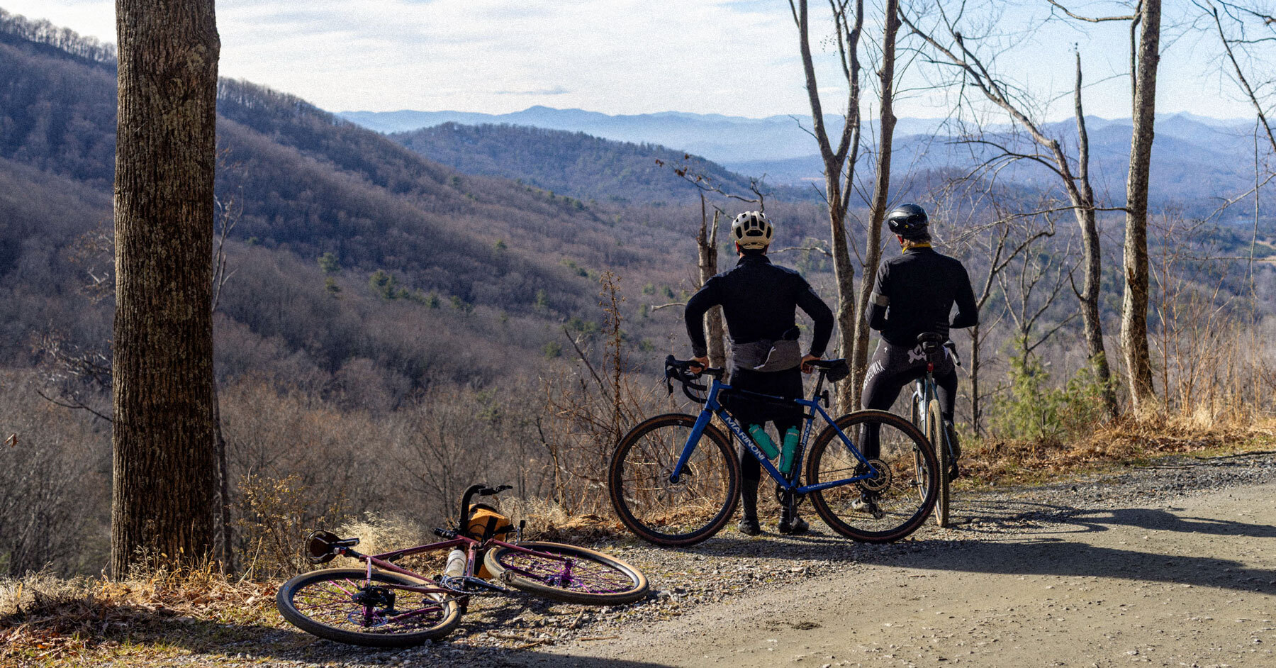
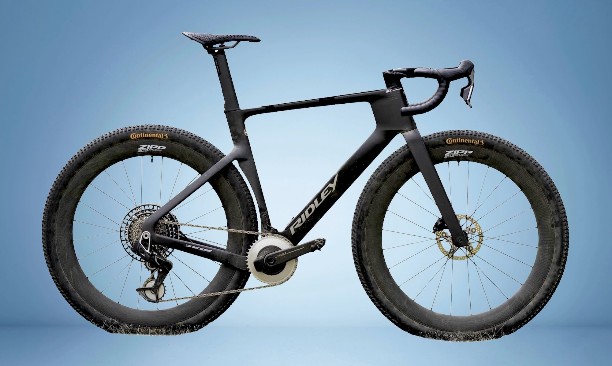
What Bike:
- A gravel bike or rigid mountain bike. We recommend tires that are at least 45mm wide.
- Make sure your bike gearing is suitable for long days.
- For reference, Lorraine rode the route on a Priority 600ADX, and David rode it on a Surly Bridge Club. Our son also completed the entire route on a Marin San Rafael with smaller tires, around 45mm. He had a bit more difficulty in some sections, but he was still able to ride the whole route successfully.
- Developed campgrounds are abundant and glamping can also be found, with a mix of informal lakeside spots and established campgrounds. Lodging is available in larger towns, though reservations are wise in peak season.
- Stealth camping is generally permitted on Québec Crown land (public land), though regulations vary by land designation (e.g., ZECs, wildlife reserves, municipal areas), so riders should always verify local rules before setting up camp.
- Resupply is available in most towns, but hours may be limited.
- There are relatively frequent bakeries, small groceries, and regional markets.
- Check out the fromageries, butcher shops, distilleries, and microbreweries along the route.
- Water is available at campgrounds and municipal sources.
- Lakes and rivers are abundant. Filtration is strongly recommended.
- Few campgrounds provide potable water, so filtration, chemical treatment, or boiling is recommended. In Angliers, the water should not be consumed (contaminated); water can be bought at the gas station, or it should be boiled or filtered
Below is a suggested 16-day itinerary. And here is a scavenger hunt for you to complete along the way:
- Photograph a covered bridge from three different decades (1920s, 1930s, and modern repairs)
- Find and taste at least one cheese produced within 50 miles of where you camp
- Locate the Ville‑Marie cave graffiti and identify at least three cartoon characters
- Track down Ville-Marie’s emblematic fish monument—a quietly iconic statue that tends to stop riders in their tracks
- Take a swim in five lakes without retracing your route
- Sample poutine in at least three towns and declare a family champion
- Spot evidence of ancient glacial activity (eskers, rock rivers, or erratics)
- Share a conversation with a local who thinks riding this far is “a bit crazy”
location Val-d’Or to Mont-Vidéo
Day 1 (38 mi, 1,475′)
Leaving Val-d’Or, the route quickly shifts from urban edges to quiet rural roads and forest tracks. Blueberry patches, small lakes, and soft gravel set an inviting tone. Camping is possible at the Lac-des-Soeurs, out of town, for free, but with no services. There is access to a lake. Mont-Vidéo offers swimming, short hikes, and an incredibly nice and challenging mountain bike experience. Make sure to stock up on homemade beef jerky at Le Grenier des Saveurs and dried strawberries and peaches at Aki.
location Mont-Vidéo to Amos
Day 2 (48 mi, 1,680′)
A longer day through the boreal forest and wildlife corridors. Cultural stops include the former residential school site at Saint-Marc-de-Figuery and The Refuge Pageau, where moose and wolves may make appearances. Amos provides full services, cafés, and a chance to restock.
locationAmos to Taschereau / Aiguebelle
Day 3 (31 mi, 928′)
Rolling farmland leads into forest roads toward Aiguebelle National Park (Taschereau entrance), which is part of the Sépaq network in Quebec and participates in the Bienvenue cyclistes program, which guarantees a campsite for travelers arriving by bicycle. Short hikes reveal volcanic cliffs and lakes, adding geological drama to an otherwise gentle day.
locationTaschereau to Lac Courval
Day 4 (42 mi, 1,204′)
Heritage defines this section, with covered bridges, historic schools, and quiet roads. The evening is best spent beside Lac Courval, where loons and still water replace traffic noise.
locationLac Courval to La Sarre
Day 5 (15 mi, 575′)
Though short, this day is rich in flavor. Fromageries, butcher shops, and microbreweries turn the ride into a moving feast, while village centers encourage lingering conversations. The hike at Le Site du Grand Héron adds another memorable stop along the way.
locationLa Sarre to Palmarolle
Day 6 (25 mi, 1,213′)
Agricultural landscapes dominate. A detour to La Montagne à Fred reveals ancient glacial formations and expansive views that hint at the region’s deep geological history.
locationPalmarolle to Roquemaure
Day 7 (34 mi, 1,385′)
The route links charming farming villages, quirky local records, and community landmarks before ending near beaches and calm lake waters in Roquemaure, renowned for one of the most beautiful sunset spots in the region.
locationRoquemaure to Duparquet
Day 9 (31 mi, 1,207′)
Rivers, rapids, and stone churches accompany the ride as it approaches Lake Duparquet. Campsites often sit just steps from the shoreline, ideal for evening swims. If you need to refuel, don’t forget to stop at Le petit glouton, one of the top three poutine restaurants of the region. However, please note that the ranking was decided by kids 12 years old and younger. Still, they are self-proclaimed poutine experts.
locationDuparquet to Rouyn-Noranda
Day 9 (40 mi, 1,378′)
A gradual transition from rural calm to urban energy. Beaches, museums, cafés, Montréal style bagel shop, and public art provide variety before a full resupply in Rouyn-Noranda.
locationRouyn-Noranda to Rémigny
Day 10 (45 mi, 2,192′)
One of the most demanding days, combining climbing, long forest roads, and limited services. The reward comes in the form of deep quiet, clear skies, and remote camps.
locationRémigny to Angliers
Day 11 (21 mi, 794′)
Short and relaxed, this recovery day follows waterways and hydro infrastructure with opportunities to explore logging heritage and fish from shore. If you veer toward Guérin for a poutine detour, you will also have the chance to roll on challenging singletracks and possibly some hike-a-bikes.
locationAngliers to Ville-Marie
Day 12 (32 mi, 1,129′)
A highlight of the treasure hunt. Riders encounter graffiti-covered caves, bakeries, chocolateries, waterfront activities (rentals available by The Coop de l’Arrière-Pays), and learn about the great lake Témiscamingue that defines Ville-Marie’s story. For the epicureans, make sure to stop at La Gauloise, one of the top three poutine restaurants of the region.
locationVille-Marie to Latulipe
Day 13 (21 mi, 1,004′)
A deliberately slow cultural day featuring creameries, a pool at the camping, short hikes, and time to enjoy small-town life.
locationLatulipe to Laforce
Day 14 (29 mi, 997′)
Quiet forest roads and interconnected lakes dominate the scenery, leading to classic Québec campground comforts and easy swimming. On the way to Laforce, you must stop at Moffet at La hutte for the best poutine of the whole region.
locationLaforce to Rapide-Sept
Day 15 (40 mi, 1,781′)
Isolation increases as long forest stretches reinforce expedition vibes. Make the detour and restock at Long Point First Nation of Winneway. Outfitter-style lodging closes the day in true northern fashion. If time allows, you have just entered a true fishing mecca, so bringing a rod would be well worth it.
locationRapide-Sept to Val-d’Or
Day 16 (48 mi, 1,995′)
The loop closes with mining heritage sites, markets, bakeries, and breweries marking a celebratory return to Val-d’Or. Not to be missed: Le Prospecteur Microbrewery, Choco-Mango Coffee/Handmade Chocolatier shop, and a descent nearly 300 feet underground in an old gold mine at La Cité de l’Or.
Terms of Use: As with each bikepacking route guide published on BIKEPACKING.com, should you choose to cycle this route, do so at your own risk. Prior to setting out check current local weather, conditions, and land/road closures. While riding, obey all public and private land use restrictions and rules, carry proper safety and navigational equipment, and of course, follow the #leavenotrace guidelines. The information found herein is simply a planning resource to be used as a point of inspiration in conjunction with your own due-diligence. In spite of the fact that this route, associated GPS track (GPX and maps), and all route guidelines were prepared under diligent research by the specified contributor and/or contributors, the accuracy of such and judgement of the author is not guaranteed. BIKEPACKING.com LLC, its partners, associates, and contributors are in no way liable for personal injury, damage to personal property, or any other such situation that might happen to individual riders cycling or following this route.
Further Riding and Reading
Here are some connected/nearby routes and related reports...
Please keep the conversation civil, constructive, and inclusive, or your comment will be removed.


 English (US) ·
  French (CA) ·